

ONE of Staveley's most popular walks at the Black Crag and Reston Scar from John Edmondson
Distance: 4 miles (6.5km); Ascent: 800 feet (240m); Time: 2 hours
Terrain: Quiet lanes and roads and grassy footpaths, including a short steep climb and a few boggy parts.
Map: Ordnance survey OL7
Start: Staveley mill yard, grid ref. SD 471 983, postcode LA8 9LR
Information
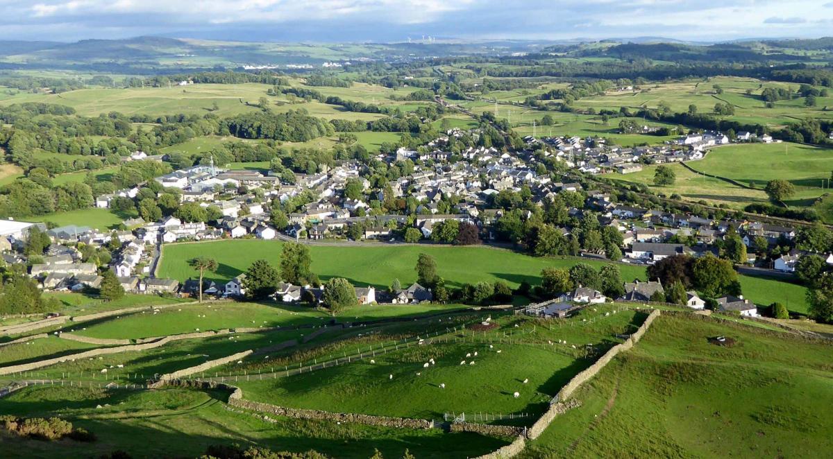
This short hill walk combines quiet, rural with hilltop scenery and offers splendid views over the Kent and Gowan valleys. It gives an overview of the parish of Hugill including a sight of Williamson’s Monument and a bird’s-eye view of Staveley.
Route Description
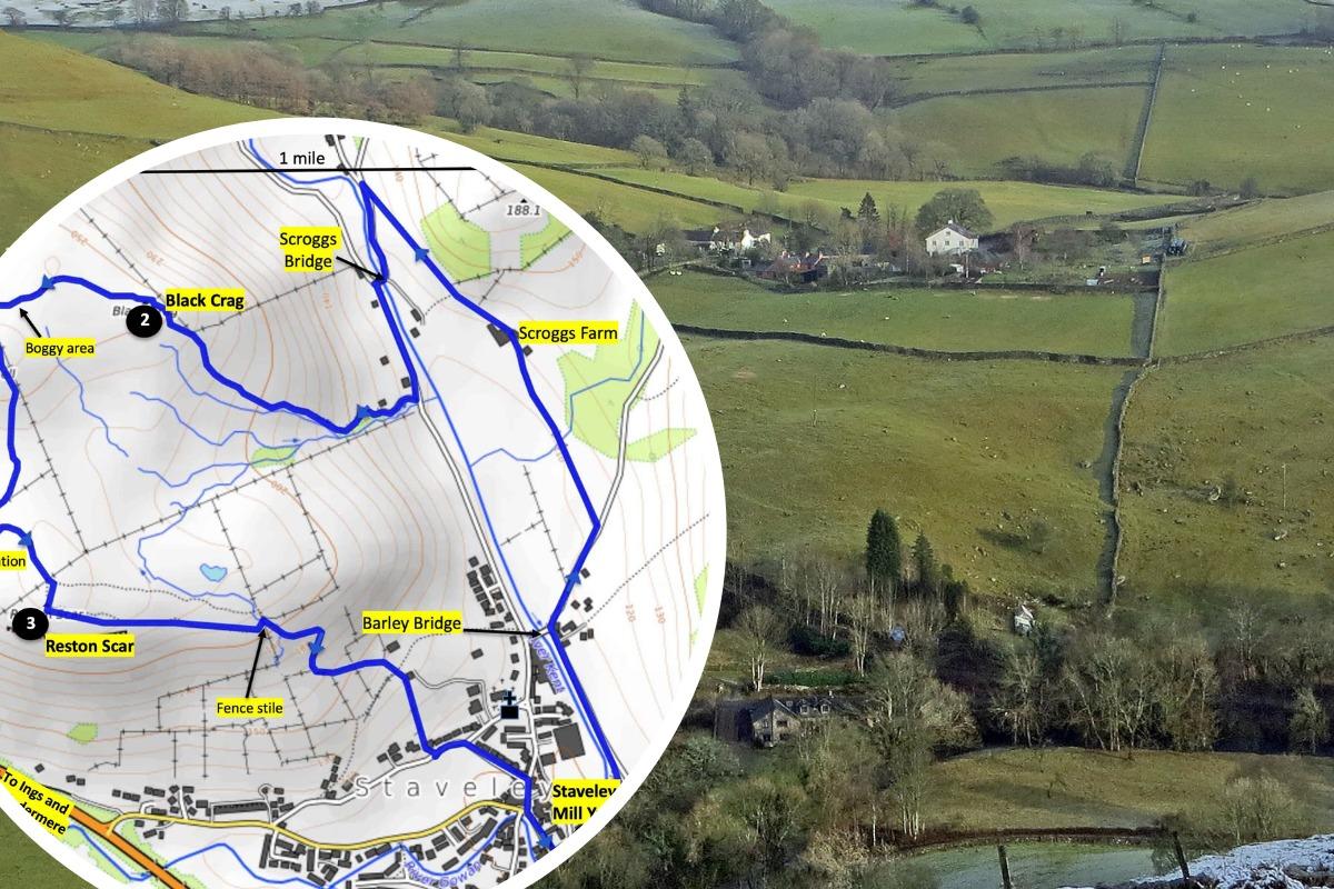
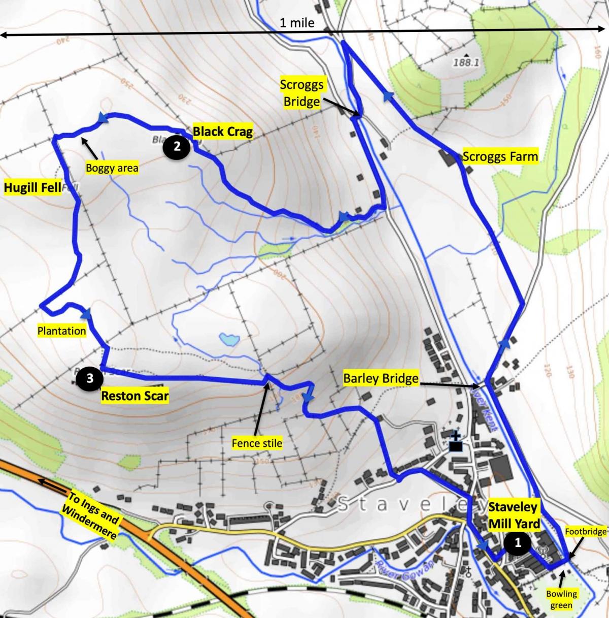
1. Leave the Mill Yard in the south-east corner, beside the bowling green. Cross the footbridge and turn left along the riverside ‘Miles without Stiles’ path past Staveley weir. On joining the road continue following the river upstream and turn right just before Barley Bridge onto Hall Lane.
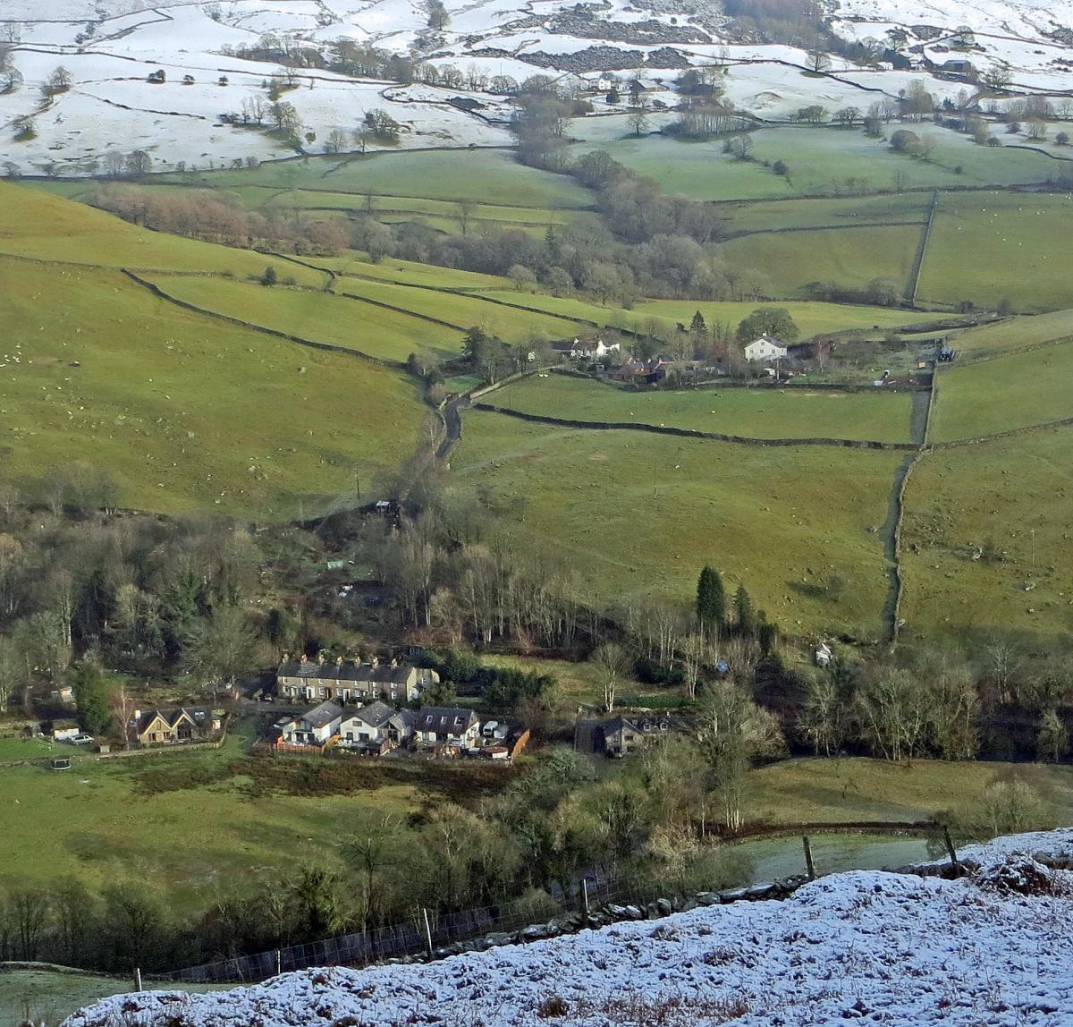
Take the first turn left and continue past Scroggs Farm to the road. Turn left, cross Scroggs Bridge, follow the road towards Staveley for 250 yards then turn right up a steep concrete driveway. Near the top, keep straight on and go through a gate leading to the fells. Follow this footpath as it bends right and climbs fairly steeply to the top of Black Crag.
From here you can admire the scenery over the Kentmere valley to Brunt Knott in the east, Williamson’s Monument to the north west with the peaks of Ill Bell, Froswick and Kentmere Pike beyond and further north. The monument was erected in 1803 by the Reverend T. Williamson, in memory of his father Thomas, who liked to walk to High Knott every day before breakfast.
2. Follow the footpath down off Black Crag in a westerly direction.
The path crosses a small but boggy valley to a field gate which is hidden by a ridge until you are about 50 yards from it.
After passing through the gate the path turns left and continues in a generally southerly direction. Make a 20-yard detour to the summit of Hugill Fell on the right, at nearly 900 feet the highest point of the walk.
The name Hugill may have been derived from ‘the high ravine’, referring to a narrow valley north of Hugill Hall.
Continue down the path which then winds to the right, passes through a wall gate on the left, goes through a plantation and then ascends to the top of Reston Scar.
3. From the summit look down over the River Gowan, the busy A591 and the village of Ings and the Lakes Railway.
The river’s name probably derives from a person called Garwain.
Descend eastwards along the line of a fence on the north side of the scar. For the best views over Staveley cross a fence stile and walk to the end of the Scar.
Descend to the left, go through a gate, turn right and follow the winding track down towards the village passing a valve house on the Thirlmere aqueduct. Turn left on Brow Lane, bear right onto School Lane and right onto Silver Street to the village hall. Turn left onto Main Street and the entrance to the Mill Yard is 250 yards on the left.


Comments: Our rules
We want our comments to be a lively and valuable part of our community - a place where readers can debate and engage with the most important local issues. The ability to comment on our stories is a privilege, not a right, however, and that privilege may be withdrawn if it is abused or misused.
Please report any comments that break our rules.
Read the rules here