


This is the third of a series of walks following the 73-mile Cumbria Way (CW) between Ulverston and Carlisle.
This linear walk uses two bus services and continues from Coniston northwards to Elterwater. The route includes some of the most popular areas of the central Lakelands including Tarn Hows and Great Langdale.
To get to the start catch the 505 bus that leaves Kendal at 9:35 and Ambleside at 10:09h. For the return journey, use the 516 bus leaving Elterwater at 16:15h.
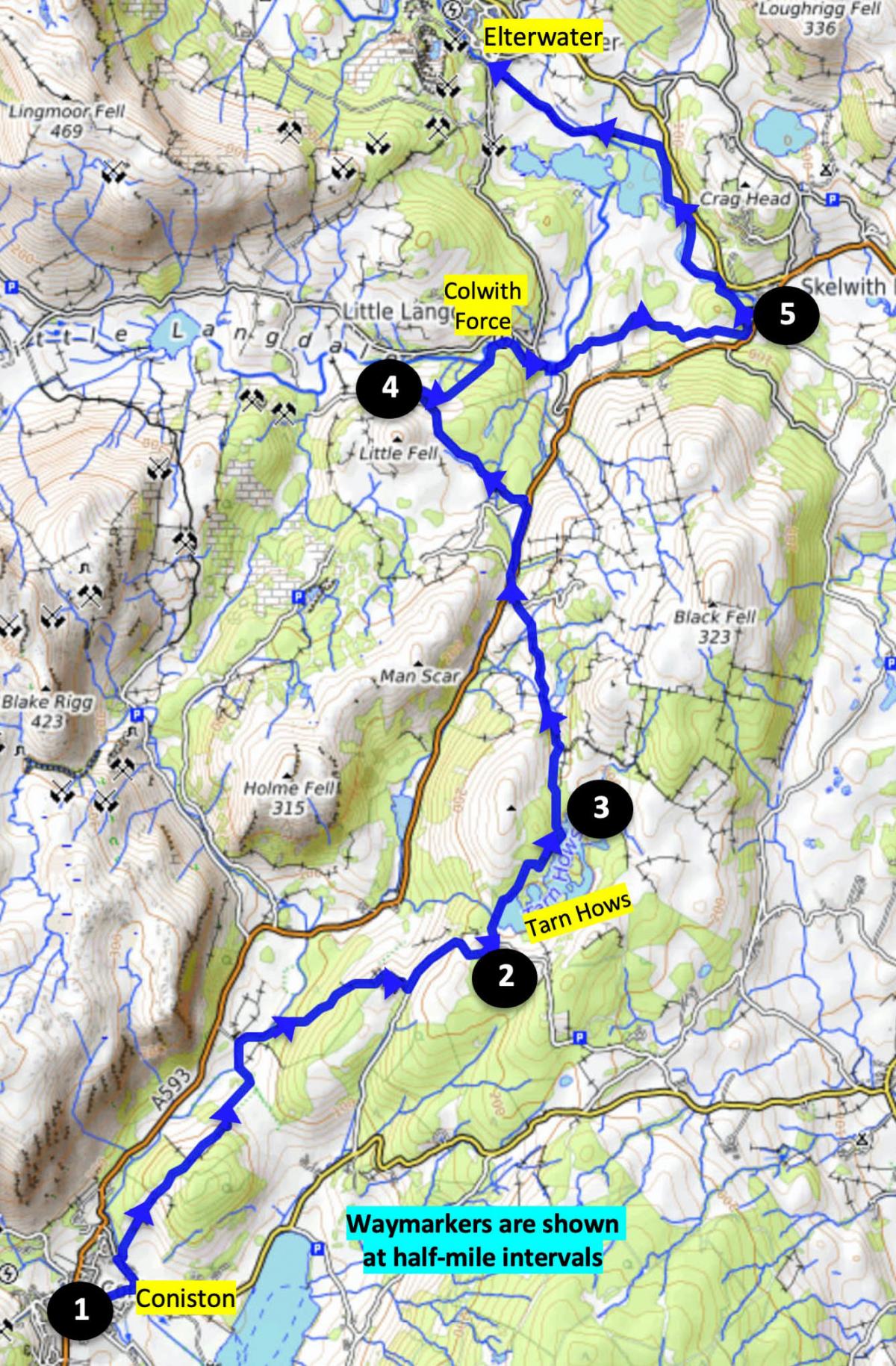
1. Facing the Crown Inn at Coniston turn right, walk along Tilberthwaite Avenue and left onto Shepherds Bridge Lane. After passing the Sports & Social Centre turn right, cross the bridge and follow the footpath veering right to the “dog house” – an ornate stone building that was used as a kennel for hunting dogs. Follow the path ahead, ignoring a branch to the right, through woodland and then descending gently past woods on the right then veering left to a gate behind oak trees. Cross the next field to a gate, turn left and follow the track beside Yewdale Beck. Just before the bridge, keep ahead to go through a kissing gate and continue alongside the Beck into Tarn Hows Wood. Follow the uphill path through the wood to the right of Tarn Hows Cottage and follow the lane to a road.
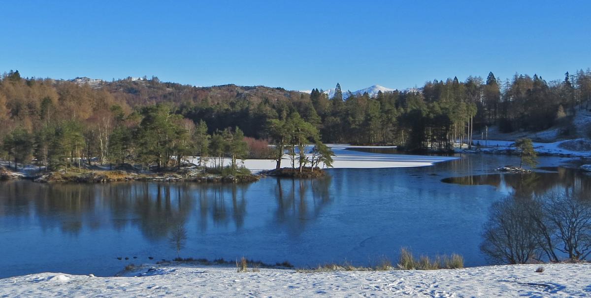
2. Turn left, walk uphill, pass the National Trust Car Park then turn left to descend to the left side of Tarn Hows. Tarn Hows is one of Lakelands most beautiful landscapes, but it is essentially man made. Before the 1850s there were 3 small tarns surrounded by farmland. James Marshall (M.P. for Leeds) and his family transformed the landscape, planting hundreds of trees and damming Tom Gill to flood the basin and create the tarn and the islands much as we see them today. Beatrix Potter (Mrs Heelis) bought the estate from the Marshall family in 1929, immediately sold half (including Tarn Hows) to the National Trust and bequeathed the rest of the estate to the Trust in her will.
3. At a junction where the main track bends right, keep left and continue to a gate leading to a main stony track. Turn left and follow the track to the A593. Cross the road, turn right and walk along the pathway adjacent to the road to a junction with a lane. Turn left then keep right and follow the tarmac lane going beside Tongue Intake Plantation on the right.
4. At High Park Farm, keep right at the cattle grid and turn right to follow the path into woodland. Optionally, descend the stony path on the left to view Colwith Force or stay on the main path ahead. Both paths lead to the road near a bridge. Turn right and after 100 yards left onto the path signed Skelwith Bridge. The path continues past Park Farm and Park House then enters woodlands and swings left to cross a footbridge a short distance above Skelwith Force.
5. Turn left and follow the popular path beside the River Brathay and Elter Water to meet a road after Elterwater village car park. To catch the bus turn right. Buses for Ambleside approach in the opposite direction and turn left onto the road on your right, so note that the bus shelter is on the “wrong side” of the road.
Walk factfile
Distance: 8 mi (13km);
Ascent 1,300 feet (460m);
Time: 4 ½ h;
Map: OS Explorer OL6
Terrain: Well-made paths
Start: Coniston bus stop,
Grid ref.SD 303 975, Postcode LA21 8EH


Comments: Our rules
We want our comments to be a lively and valuable part of our community - a place where readers can debate and engage with the most important local issues. The ability to comment on our stories is a privilege, not a right, however, and that privilege may be withdrawn if it is abused or misused.
Please report any comments that break our rules.
Read the rules here