

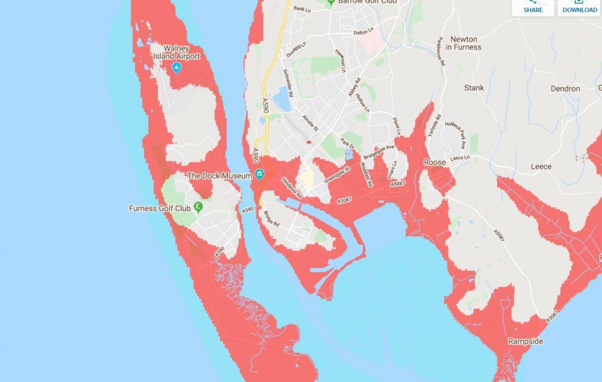
CLIMATE experts are predicting that most of Walney could be underwater by 2050.
According to models, advancing sea levels could leave it exposed to flooding, covering all but two small sections of the island if serious action is not taken on climate change.
The interactive map, shows which parts of the UK will be enveloped by rising tides in three decades' time.
Large sections of the Furness and Morecambe Bay coast are forecast to succumb to rising sea levels.
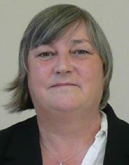
Walney councillor Helen Wall said: "It's sad that these beautiful places are there but won't last forever.
"Unfortunately we have seen it coming and the erosion has been worse than expected.
"We were told 20 years ago that Walney would be safe for the next 100 years but it's progressed more than we thought.
"It's a real worry.
"Walney is a really vulnerable place."
Cumbria County Council has been developing a long-term strategy to protect the coast.
Several authorities have been working on ways to manage coastal erosion over the next century and have consulted the public for their views on a way forward.
A large section of the A590 stretching from Levens to Lindale is also projected to be submerged and highways bosses say they are planning for the future.
A spokesman from Highways England said: “The resilience of our network to rising sea levels is something that we are conscious of and we will continue to work with local partners to ensure that the strategic road network continues to enable reliable journeys to the places it connects.”
The findings of the study by Dr Scott Kulp and Dr Benjamin Strauss, senior computational scientist and chief scientist respectively at US-based climate change research group Climate Central, were published in a peer-reviewed paper in the scientific journal 'Nature Communications'.
By current projections, sea levels around the country could rise between 2ft and 7ft by the end of the century.


Comments: Our rules
We want our comments to be a lively and valuable part of our community - a place where readers can debate and engage with the most important local issues. The ability to comment on our stories is a privilege, not a right, however, and that privilege may be withdrawn if it is abused or misused.
Please report any comments that break our rules.
Read the rules hereLast Updated:
Report this comment Cancel