

HOMES on the coast of Furness are at long-term risk of flooding, the Environment Agency has warned.
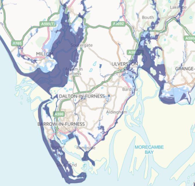
New data plotted on a map has shown hundreds of homes on Walney are at high risk of flooding along with others off the coast of Millom and Ulverston.
The total number of properties at risk of flooding in the county stands at 21,518, the agency said.
High risk means there is a strong chance of flooding each year, even despite existing flood defences.
The Environment Agency said 8,133 properties benefit from flood defences and 953 from tidal defences.
Stewart Mounsey, the Environment Agency’s flood risk manager, said: “We will never be able to guarantee a completely flood-free future, and so we encourage anyone living or working in a flood risk area to be aware and to be prepared.
“The Environment Agency can support you by; signing you up to receive free flood warnings, helping you to produce a personal flood plan, offering property resistance and resilience information and supporting the formation and ongoing work of a community flood action group.”
Barrow Borough Council says it has a coastline approximately 63km long, of which around 22km are defended against either erosion or flooding.
The council is responsible for 7km of that defended area with the rest managed by other bodies and private companies.
The remaining 41km of undefended coastline consists of shingle beaches, clay cliffs, sand dunes and salt marsh.
The whole of the borough’s coastline, except for a short section on Walney between Hillock Whins and Sandy Gap, is designated internationally, nationally or locally as environmentally important.
Concerns have been raised in the past about Walney’s resilience in the face of floods, with fears the island could eventually split it in two.
Authorities have been working on ways to manage coastal erosion over the next century and have consulted the public.
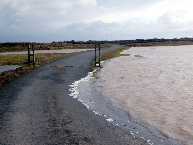
The Environment Agency said more than 2,000 flood alerts had been issued since 2006 along with 72 severe flood warnings.
Walney’s South End Caravan Park recently applied for permission to install a new flood defence bund to further protect itself from the sea.
An ecological impact assessment said the proposed area is ‘rough grazing occasionally inundated by tidal water’ and ‘the frequency of the inundation is believed to be increasing as the shoreline to the west erodes’.


Comments: Our rules
We want our comments to be a lively and valuable part of our community - a place where readers can debate and engage with the most important local issues. The ability to comment on our stories is a privilege, not a right, however, and that privilege may be withdrawn if it is abused or misused.
Please report any comments that break our rules.
Read the rules hereLast Updated:
Report this comment Cancel