
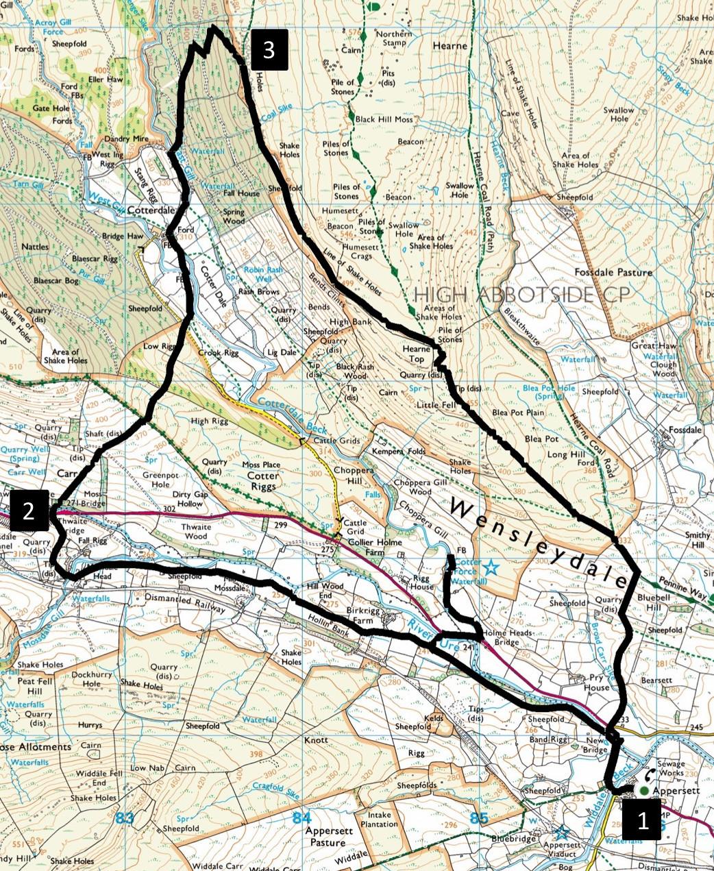
WANDER along the upper part of Wensleydale then amble over fells to the peaceful village of Cotterdale. On the way make a short excursion to view the comely Cotter Force. Climb through woodland up to the Pennine Way and descend a track with splendid views of the Wensleydale valley.
Start from the parking area next to Appersett Bridge.
Map reference SD 858 907, postcode DL8 3LN.
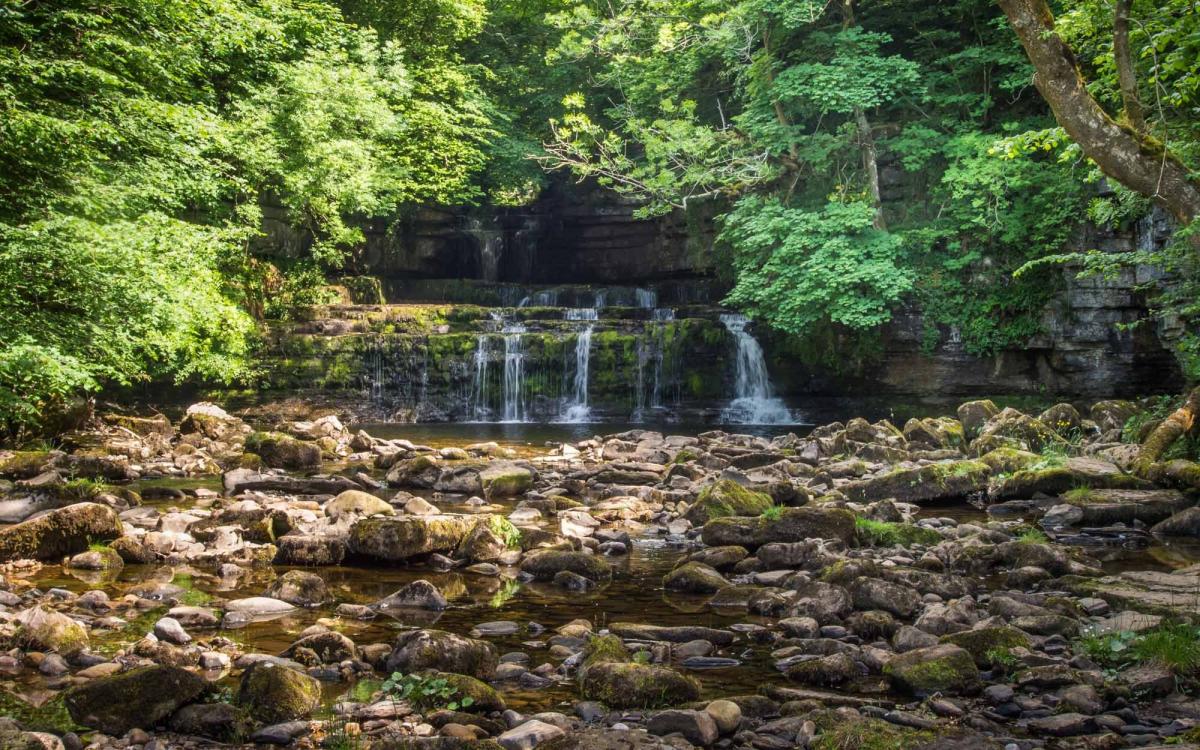
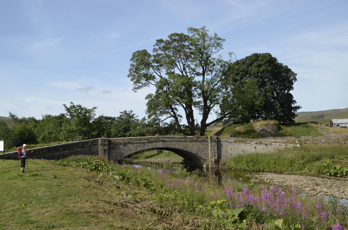
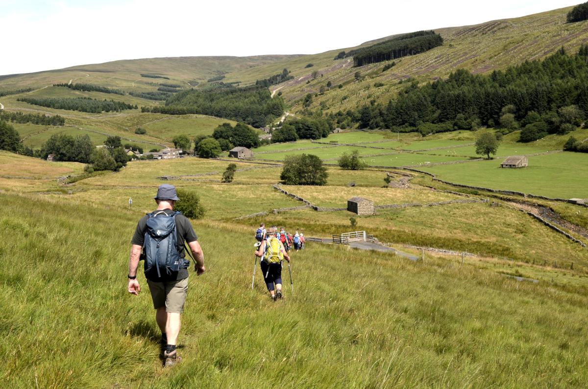
1 From the parking area turn right, cross the bridge then turn left onto the path signed Mossdale Head, going alongside the wall on the right. The path turns left and follows the River Ure to a footbridge across a beck then crosses two fields to the right of a barn. Turn right onto the farm track signed A684, cross the river then turn right onto the A684. Cross the road bridge then turn left onto the path signed Cotter Force. After viewing the waterfall return to the road, turn right then left back onto the track signed Thwaite Bridge. Stay on the stony track (signed Mossdale) keeping straight on at a right bend near a barn. Leave the track to the right at a fingerpost by an embankment. Turn right onto a track over a bridge and view Mossdale Falls on the left. The viaduct is a part of the Wensleydale railway that operated between Hawes and Garsdale between 1878 and 1959. Keep straight on where the track bends left go uphill, through two gates, turn right at a third gate and descend to the A684. Cross the road and the River Ure at Thwaite Bridge to the footpath signed Cotterdale Road.
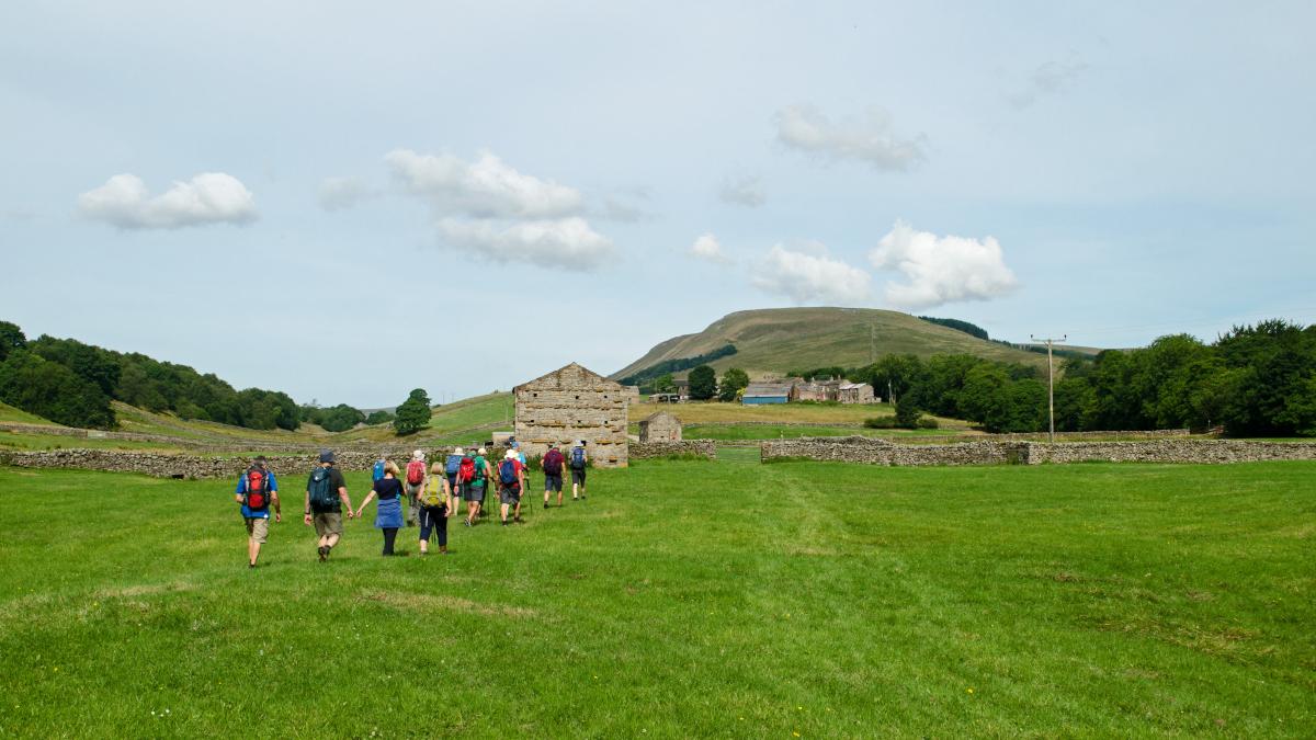
2 The path climbs over the shoulder of High Rigg to a gated wall stile, crosses grassland to a ladder stile then descends towards Cotterdale. Cross the lane and follow the footpath bearing left to go along the course of the River Cotter to the peaceful village of Cotterdale, whose name may come from the old Norse word kotar, meaning huts. Most of the cottages date from the 17th Century when coal was mined nearby. Many are roofed with local Hardraw flagstones so that they blend with the landscape. Turn right, walk through the village and continue along a stony lane. Cross a farm track then go over the river via a wide footbridge onto the bridleway signed Jinglemere Bog. Ascend through Cotterdale Woods and turn left onto the track signed Bridleway. Follow the zigzag track uphill to go through pine woodland up onto High Abbotside Moor.
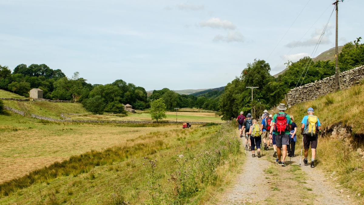
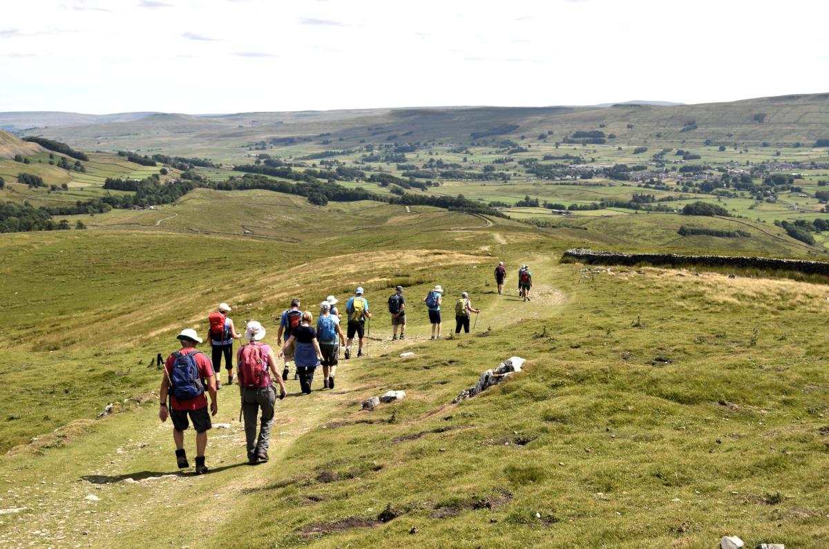
3 The track continues southwards and goes above the next wood (although it might soon be felled) below the summit of Humesett on the left. At the highest point of the grassy track, merge with the Pennine Way and descend (signed Hardraw) down a stony lane to a path junction near a wall. Enjoy great views over the valley ahead. Keep straight on along the walled track for a quarter of a mile then turn right onto a path signed New Bridge. Descend steeply by the wall on the left, cross a ladder stile and keep straight on at a fingerpost junction. Follow the waymarked path to the junction of the A684 and the road to Hardraw. Turn left onto the A684, crossing road bridges over the River Ure and Widdale Beck to return to Appersett.


Comments: Our rules
We want our comments to be a lively and valuable part of our community - a place where readers can debate and engage with the most important local issues. The ability to comment on our stories is a privilege, not a right, however, and that privilege may be withdrawn if it is abused or misused.
Please report any comments that break our rules.
Read the rules here