
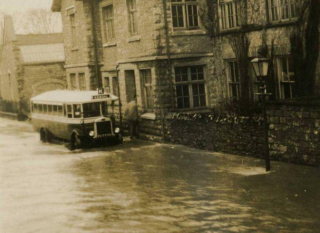
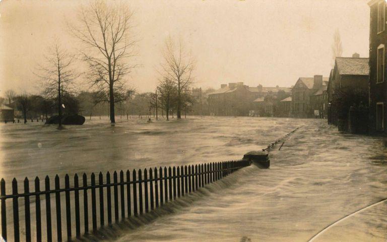
WATER flowing gently under stone bridges in historic market towns is part of the idyllic view of Cumbria which attracts tourists but it isn't always like that.
Storms and floods in recent years have seen major destruction and flooding to homes in places like Keswick, Ulverston, Haverthwaite, Carlisle and Cockermouth.
The influence of water on Kendal was explored by Geoff Brambles at a talk called How Water Shaped a Town for the Cumbria Industrial History Society at the Shap Wells Hotel, Shap.
He referred to the most recent Storm Desmond and noted: "If you have flat ground anywhere near a river, that is a hazard."
There had been major flooding in Kendal in 1898 and records show other serious events in 1831, 1861, 1927 and 1954.
Water-powered mills developed near the river and bridging points drew people together where goods and services could be offered.
He said: "Flat land is a great temptation to builders."
Kendal was famed for its wool and this could be washed on steps beside the River Kent.
Tanneries also polluted the river with waste products.
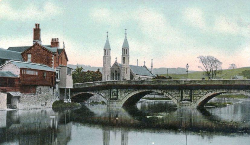
Among the town's bridges are Nether Bridge which started as a packhorse crossing but was widened in both the 18th and 20th centuries, Miller Bridge which was built in 1818 to serve the Kendal to Lancaster canal and Stramongate Bridge, built in 1794 very close to an earlier crossing.
He said: "In the right light you can still see the ghost of the old bridge."
Kendal's traders and industrialists had battled for 20 years to get a canal link to Lancashire and it was completed to the town in 1819.
Much of its trade was in taking limestone out and bringing in coal from Wigan.
An inventory of goods at a canal head warehouse damaged by fire in 1839 gives an indication of the other goods which could be moved by horse-pulled barges on the waterway.
Cotton, rags for making paper, hops, flour for the co-operative society, tea, cheese, wool, cloth, china and gunpowder.
He said: "The canal was an enormous economic boost to the town."


Comments: Our rules
We want our comments to be a lively and valuable part of our community - a place where readers can debate and engage with the most important local issues. The ability to comment on our stories is a privilege, not a right, however, and that privilege may be withdrawn if it is abused or misused.
Please report any comments that break our rules.
Read the rules here